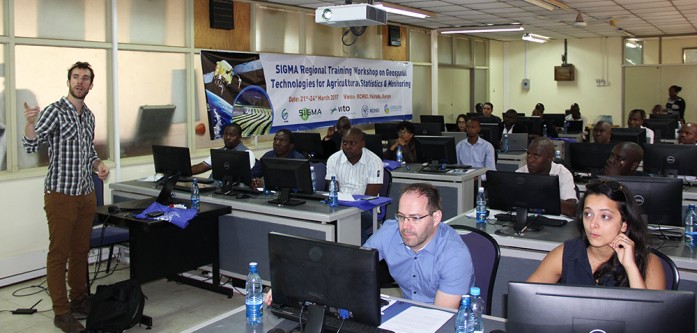
A four-day (March 21-24, 2017) SIGMA Regional Training Workshop on GIS for Agricultural Statistics and Monitoring was held at RCMRD). The workshop aimed at gathering regional stakeholders and institutions active in agricultural monitoring and statistics, and interested in innovations in satellite and in-situ geospatial technologies for monitoring of agriculture. It was organized by regional East Africa project partner RCMRD with ITC (Arno Van Lieshout, Eduard Westinga) and VITO (Roel Van Hoolst), together with expert contributors from the SIGMA partner consortium IIASA (Linda See), GISAT (Neha Joshi) and EFTAS (Carsten Haub).
ITC and VITO led the workshop whose other objectives was to impart knowledge on efficient use of Geo-Information for monitoring and mapping of various agricultural processes and systems. “During the workshop, newest methods and tools used for ground sampling, earth observation based agricultural monitoring and data validation, developed within SIGMA were exposed,” the SIGMA trainers said.
“Current progress on translation of research methods into operational monitoring were shown using hands on training sessions,” said Degelo Sendabo, RCMRD’s Remote Sensing Officer. Degelo said the features of remote sensing and GIS are the reliable means of collecting information on crop monitoring and damage assessment, crop growth modeling, crop production and area estimation.
Prof. John Kiema, RCMRD Director of Technical Services Directorate in his address said that food security is one of the major challenges that need solutions. He emphasized the role of RCMRD, which is “to promote sustainable development in the member States through generation, application and dissemination of geo-information and allied ICT technologies, products and services.”
Prof. Kiema added, “RCMRD functional programmes have moved away from service technology framework (e.g. Remote Sensing, Geodesy, Cartography etc.) to problem solving applications in natural resource and environmental management. RCMRD is now providing service on demand driven basis.” He emphasized that sustainable agricultural land use critically depends on continuous assessment and monitoring of agricultural processes.
He further said that satellite based remote sensing and geographic information system substantially increases the value of information on agricultural land usage, crop production estimation and climate change assessment. He congratulated organizers for taking lead and organizing workshop. He hoped that they would continue playing their part for development of the agriculture sector.
In the four-day workshop, participants used satellite imagery, remote sensing and GIS applications as tools at various scales in assessing the evolution of vegetation cover. The workshop also discussed the way forward in integrating new techniques into current professional workflows of the participants and regional stakeholders.
Participants from 13 countries including Burkina Faso, Ethiopia, Niger, Uganda, and Zimbabwe among others, and agricultural scientists, GIS & remote sensing analysts, RCMRD staff members and interns attended the workshop. See photos here
*Note:
The SIGMA project-Stimulating Innovation for Global Monitoring of Agriculture – is a global EU support action to GEOGLAM.


