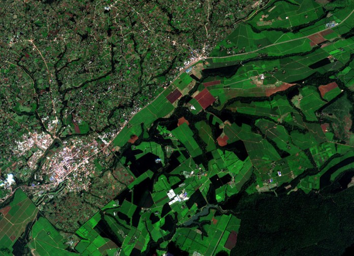
The Regional Centre for Mapping of Resources for Development (RCMRD) has the capacity to archive, download and process Sentinel 2 data and make it available to institutions in Africa. RCMRD also recently received Sentinel 2 datasets from the European Space Agency (ESA) through the Technology Informatics Guiding Education Reform (TIGER) Bridge: Data Dissemination Service. The data provides coverage for the whole continent of Africa. Sentinel 2 was launched on 23rd June, 2015 and is equipped with the state-of-the-art Multispectral Imager (MSI) instrument, which offers high-resolution imagery.
The satellite is an imaging mission within the Global Monitoring for Environment and Security (GMES) program, jointly implemented by the European Commission (EC) and ESA for global land observation. The Sentinel 2 mission is a land monitoring constellation of two satellites that provide high resolution imagery and provide continuity for the current SPOT and Landsat missions. The mission provides a global coverage of the Earth’s land surface every 10 days with one satellite and 5 days with 2 satellites, making the data of great use in on-going studies. It provides data at 10m and 20m for land cover mapping in different channels, 13 in all. Data from the satellite is useful in land observation, land use and change detection, providing support in generating land cover classes, disaster relief support, climate change monitoring, among other applications.
References
European Space Agency Sentinel 2
What is Sentinel 2?


