
Profile
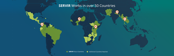
SERVIR, a joint initiative of the National Aeronautics and Space Administration (NASA) and the United States Agency for International Development (USAID), works in partnership with leading regional organizations worldwide to help developing countries use information provided by Earth observing satellites and geospatial technologies for managing climate risks and land use. The SERVIR network of regional hubs currently covers the Eastern and Southern Africa regions, the Hindu-Kush Himalaya region, the Mekong region, the West Africa region and the Amazon Region.
SERVIR-Eastern and Southern Africa (SERVIR-ESA) is implemented by the Regional Centre for Mapping of Resources for Development (RCMRD). The overarching goal of the SERVIR project is to improve environmental management and resilience to climate change. With an eye toward this goal, the SERVIR project works to build the capacity of SERVIR regional hub institutions, governments and other key stakeholders to integrate earth observation information and geospatial technologies into environmental decision-making.
The SERVIR project, which in Spanish means ‘to serve’, provides geospatial applications, services, and capacity building for sharing, integrating, mapping, and forecasting using different kinds of geo-information from different sources.
NASA’s work with the SERVIR project focuses on providing technical support in access to decision-support tools, Earth Observation data and capacity development. The work of USAID is focused on building awareness and capacity among the community of users, as well as improving and understanding the impacts of SERVIR. Each SERVIR project centre or ‘hub’, is hosted by an international technical organization that serves multiple countries within its region. The regional SERVIR project hubs are the primary interface between users of SERVIR project’s services in developing countries and NASA research collaborators.
Objectives
The SERVIR Eastern and Southern Africa focuses on supporting RCMRD as a regional organization to work with technical institutions to achieve the following objectives for the region and member countries in a sustainable manner:
- Improving Capacity to use Information. Building the capacity of analysts and decision makers in government, civil society groups, and the media to integrate geospatial and Earth observation data, including climate data, and technologies into their analysis, policy, planning, management, and communications.
- Improving Awareness of and Access to Information. Raise awareness of and increase access to geospatial and Earth observation data and information, including climate data, by improving management of and access to existing and new data and information at national and regional levels.
- Increasing Provision of User-Tailored Data and Tools for Decision-Making. Creating user-tailored geospatial products and services (such as decision support tools, applications, models, dissemination, and training) to get information to people who need it to address priority climate and development issues, in collaboration with NASA and other international scientists.


