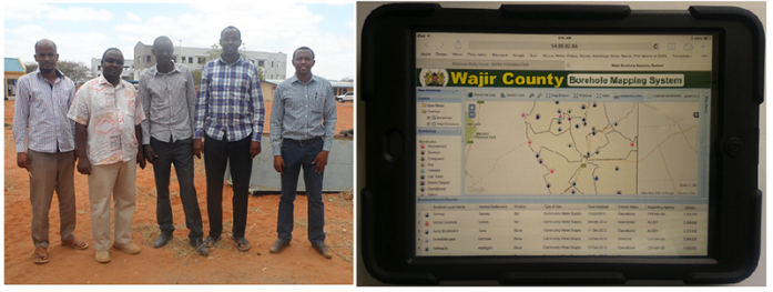
In the past one month, RCMRD has been building the capacity of Wajir County in Kenya on how to use a GIS based Water Sources Application designed by SERVIR E&SA. The one-month long training covered three key topics, including (one) GIS skills for data collection, processing, analysis and reporting; Information Technology skills for
database management and server management, (two) Managing the GIS based application, that is, updating records, adding records, and (lastly) extracting data from the system. The overall objective of the Water Sources Application is to equip the county government of Wajir with a fully functional and sustainable GIS Web-Mapping Water Resource Management System. Having a functional system in place would ultimately help the county plan and manage their water resources, dominantly made up of boreholes. The training was funded by World Vision. The system can be accessed here


