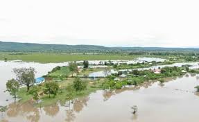
Floods and other water-related disasters greatly impact local populations across the globe. Following the onset of flooding, remotely sensed geospatial data serves as a critical resource for surface inundation maps that can be combined with other social and infrastructure information to aid in disaster response efforts. These maps are increasingly valuable in remote and isolated regions where access to information, communication, and infrastructure may be limited. However, these datasets have varying latencies, spatial, temporal, and radiometric resolutions, formats, and processing methods making it difficult for users to produce timely geospatial flood maps and use the data in a meaningful way. Furthermore, traditional surface water mapping approaches are based on individual sensors that may not capture floods due to cloud cover, repeat cycle or spatial resolution challenges.
Given the large quantity of data needed to monitor these events, cloud-based resources offer a means to consolidate and streamline the process of accessing, processing, and visualizing flood maps. Moreover, multiple satellite sensors can be leveraged via data fusion to deliver consistent information leveraging the advantages of multiple sensors. The HYDRologic Remote sensing Analysis for Floods (HYDRA Floods) system was developed specifically to leverage multi-source satellite information in a cloud-based environment (i.e. Google Earth Engine) to provide best available information regarding surface water via data fusion.
The virtual training will be held from November 30 to December 3, 2020. The main purpose of this training workshop is to introduce in detail the various techniques of surface water mapping and step-by-step methodology that HYDRAFloods uses for accessing, preprocessing, and producing data fusion surface water maps leveraging Google Earth Engine.

Presentations, hands on exercises, and group discussion will ensure that participants have a working knowledge of these techniques and the HYDRAFloods tool. After the workshop, participants will have gained an understanding of surface water mapping and be able to confidently use the HYDRAFloods processing workflows for generating surface water maps.
By the end of this training course, participants will:
● Understand contemporary surface water mapping methods applied using Google Earth Engine
● Be confident in applying the HYDRAFloods processing techniques for created data fusion surface water maps
● Exchange knowledge and experience on the applications of satellite imagery for water mapping


