Wetlands provide invaluable ecosystem services and contribute significantly to food security around the world. To maintain these functions, wetlands need to be protected from rapid transformation and overuse. Spatially-explicit information is required for sustainable wetland management. Development of wetland maps based on remote sensing requires a clear-cut definition of wetlands. This review was undertaken to improve the understanding of these habitats from a remote sensing perspective and to determine available wetland map layers for the East African countries of with the GMES and Africa Project.
The objective of this field mission was to validate the data processed and cross check the accuracy as well as sharing experiences for the local experts from the focal institution.
This study includes three components:
- Review of the availability and types of wetland definitions from the scientific literature record (including 245 separate references);
- Systematic analysis of land use/land cover classifications and the conceptual approaches and spatial coverage of wetland classes for each system;
- Depiction of wetland layers and a discussion of their suitability for use in regional inventories.
2. Summary of the Activities
The validation was made based on the first round data collection, interpretation and analysis. After discussing with the EGII staff additional relevant spot to be visited were identified. All study areas are within the Great East African Rift Valley wetlands area. Each site’s validation is summarized as follows.
The study includes three components: a)Review of the availability and types of wetland definitions from the scientific literature record (including 245 separate references); b) Systematic analysis of land use/land cover classifications and the conceptual approaches and spatial coverage of wetland classes for each system and c) Depiction of wetland layers and a discussion of their suitability for use in regional inventories.
The validation was made based on the first round data collection, interpretation and analysis. After discussing with thevEthiopian Geospatial Information Institute (EGII) staff additional relevant spot to be visited were identified. All study areas are within the Great East African Rift Valley wetlands area. Each site’s validation is summarized as follows:
Beseka/Metehara: Lake Beseka is located around 180 Kms east of Addis Ababa. It is known for its expansion from pond to lake in the past 20 years. It is a new lake created by the geological formation and became one of the rift valley lakes of the country. It ts expansion has affected the infrastructure like Addis-Djibouti high way, railway and the Metehara town as well as the surrounding sugar plantation.
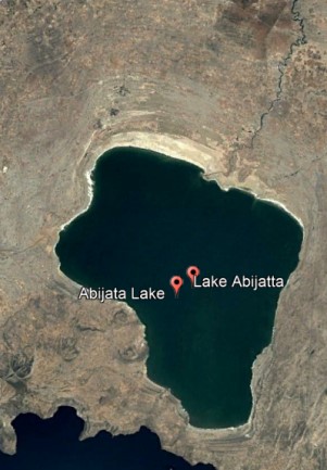
2.2 Lake Abijata
This lake is one of the shrinking lakes of the region. Its area is dramatically decreased since 1990s. Currently it is looking like smaller pond. Fortunately due to heavy rains of 2020, its area is a bit increased. Major factors to affect the lake are both anthropogenic and associated climate changes.
2.3.Lake Hawassa
This lake has issues every year and affects the surrounding environment. Its wetlands fluctuate from time to time depending on climatic, socio-economic and geological factors. In one side the urban area has been affecting the wetlands and on the contrary in some areas the lake has invaded the croplands and infrastructure.
2.4. Boyo Wetland
Boyo used to be a wetland and home of hippopotamus as well as many birds and fish. Currently it has been badly affected by anthropogenic factors like expansion of croplands and grazing areas. Its size has been decreasing from time to time. Unless measures are taken by the concerned groups, the predictions indicate that the wetland may not exist in the future
2.5. Lake Chamo
Lake Chamo area is among the endangered wetlands because of sediments coming from the surrounding highlands due to expansion of croplands. The expansion of the lake is expanding and affecting the surrounding plantation farms and closed shrublands.
3. Regional Reference Geographic Vector datasets
Vector datasets collected from different organizations like GII, Central statistics Agency and Geological Survey Ethiopia covering the whole country include:
- Administrative Units
- Hydrological
- Infrastructure
- Climate
- Soil
- DTM
Such data will also be useful for other projects the center shall implement.
4. Capacity Building GII Staff
The staff assigned was a junior one and guided how to interprete satellite images, how to use mobile mapping and how to identify sites with a GPS. Further the community in the area were made aware of what is going on with the wetlands. Most of them were found to be well aware of the impact and shared their experience on how the environmental degradation started and going on. Major factors affecting the wetlands according to the locals are agricultural population pressure, overgrazing and urbanization.
5. WAY FORWARD
- Finalizing of the processing of data for the wetlands validated in Ethiopia
- Preparation of the report and publishing in the bulletin of the project.
- Sharing information through reports, workshops and seminars.


