The Regional Centre for Mapping of Resources for Development (RCMRD) hosted its third International Conference (#RIC2019) and the fourth AfriGEO Symposium in Nairobi, Kenya from August 12-16. The objective for this joint event was to spur the exchange of ideas on fast tracking the application of Earth observation and geo-spatial technologies in development decision making with the theme of “Earth Observation for Evidence-Based Decision Making."
Several hundred attendees from Kenya, Africa, and across the world gathered for in-depth discussions on how the latest innovations in satellite data and geospatial technologies can be harnessed to address the United Nation’s Sustainable Development Goals (SDGs), including food security and gender inclusion. Building on the first RIC held in 2017, this conversation continued during the week by bringing on board more industry, government, researchers, academia, and community players with the focus of discussing the relevant use of Earth observation in promoting sustainable development goals.
On the first day, His Excellency, Kenya's Deputy President Dr. William Ruto, officially opened this event by announcing that the Government of Kenya will intensify its support to scientific research through increased funding to boost the quality of information for better informed planning. Dr. Ruto further stated that through applications developed at RCMRD, in collaboration with partners, "we can now monitor crop conditions from planting to harvesting, and thus help the country plan well on food security for its people." Through geo-spatial technologies, he challenged participants to seek further solutions to the problem of food distribution and market systems in the region, to not only foster efficient trade, but also ensure “that a Kenyan should not die of hunger when there is a surplus in a neighboring country, or even county.”
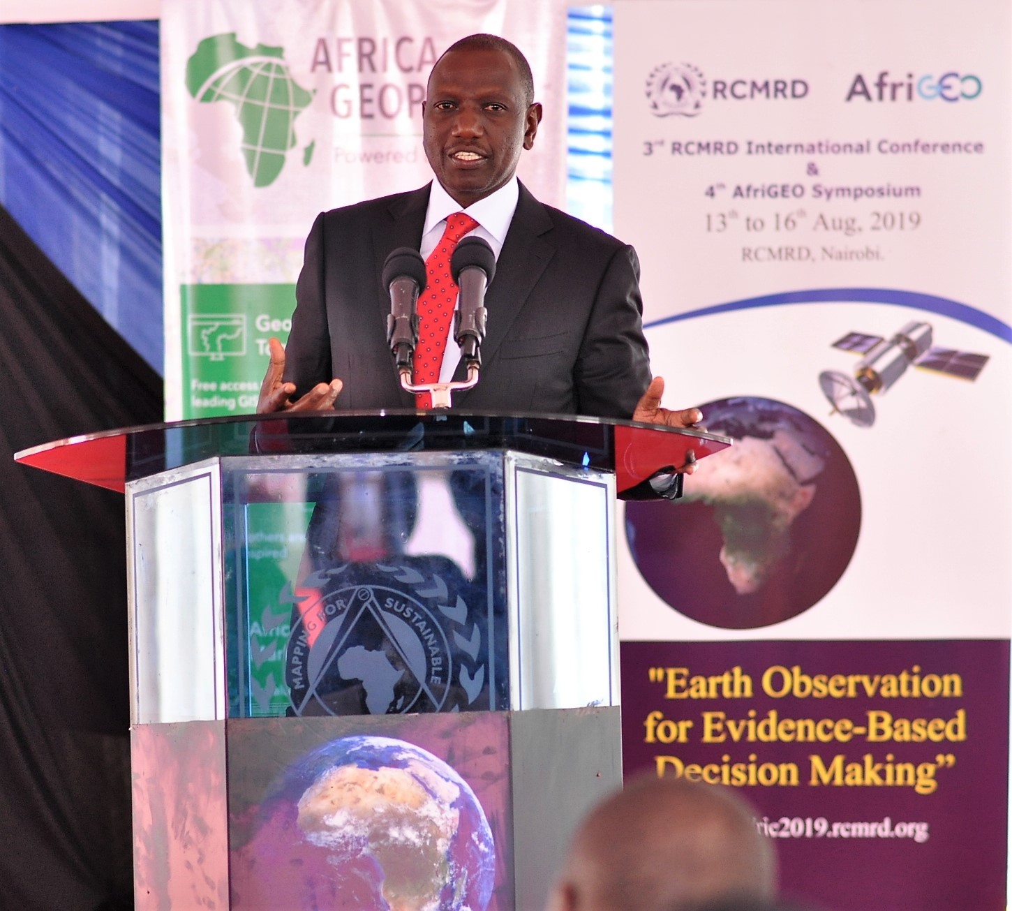
"I am pleasantly informed that our neighbors in Rwanda have embraced drone technology to provide essential health services such as delivery of medical supplies." Such examples, Dr. Ruto said, “inspire us to see that Earth observation and responsible use of space should drive our inquisitiveness to seek solutions for problems facing our communities.”
"Like the late Steve Jobs would put it, as we seek answers for these issues, we should ‘stay hungry, and stay foolish’, simply, keep learning." He said a lack of right information and a supply of ‘stale information’ continued to haunt the turnaround of Africa. “Proper planning is a function of quality and accurate information; information that is well researched, backed by knowledge and evidence,” Dr. Ruto told the participants. He challenged scientists to “step in with the right prescriptions” that would propel this continent forward. “We should not lose time. Neither should we make wrong decisions,” Dr Ruto insisted, adding that scientists need to partner with the government and public institutions in producing accurate data that can guide the development of Africa. "I am happy to note that the Government of Kenya has fully embraced digital data and information to help the country fast track the achievement of the BIG4 Agenda spearheaded by His Excellency President Uhuru Kenyatta."
The Kenya Lands Cabinet Secretary, Dr. Farida Karoney, also spoke at the opening and made the case that science and innovation should be at the center of tackling challenges facing Africa. The Secretary noted that technology was a crucial player in the attainment of the sustainable development goals. “Crucially, it is these research-backed data that would drive the Big Four agenda in Kenya,” she said. I see a clear linkage between accessibility of education for societal benefit and the information streams derived from Earth observation technologies. The Secretary added that our youth are now more technology savvy and ICT literate than any other young generation in history. "Maybe some of you made intelligent choices of the routes to use to get here, facilitated by Google Maps, and that tells you exactly what I mean, Geo-spatial Science and Technology is already playing a central role in our daily decisions as well national endeavors to attain development goals. I need not emphasize how Earth observation is transforming decisions in transport, agriculture, wildlife management among others."
NASA Project Scientist for SERVIR (a joint USAID/NASA initiative), Dr. Ashutosh Limaye, stated that technical exchanges like #RIC2019 are critically important, they expand our horizons and brings a new way of analysis, or a different perspective on the issue at hand. "Earth observations provide a vantage point from space that is unique. It knows no boundaries; at the same time, it provides us with an opportunity for objective analysis." Dr. Limaye went on to list examples of how SERVIR is working to help strengthen the capacity of countries in the region to better address critical development challenges such as food security, water management, and drought monitoring through Earth observations.

Andre Nonguierma, Chief, Geospatial Information Management (GiSS) of the United Nations Economic Commission for Africa (UNECA) stated that “Earth observation is not only about technology, data, or human capacities. It is, after all, a matter of lack of appropriate policies and institutional governance for information management in most of African countries. And we all know that policy development is a highly sensitive issue, as it involves people, end-users and decision/policy makers, their influence and their privileges in the respective communities concerned. Therefore, any process should start in the minds of the people, the mind of the most influential ones: policy makers and decision-makers. And I am elated to have the Deputy President of Kenya with us here today. This is a strong signal that the spatial awareness is improving.”
Dr. Emmanuel Nkurunziza, Director General of RCMRD, welcomed participants by stating, “As a participant in the 3rd RIC and 4th AfriGEO Symposium, I task you to realize that the job is far from over. Our people continue to face immense challenges, many of which can be addressed through provision of timely geo-information services. Thus, we must see ourselves beyond mapping or geo-information specialists, and embrace other specialties as co-developers of a suite of tools and information packages required to address problems in agriculture, water, environmental conservation, security, surveying, trade and job markets, etc. We must step-out and understand policy making dynamics and provide disruptive innovations in that space, for our work to be effective.
Dr. Nkurunziza went on to state, “I wish to reiterate that partnerships are key to our development agenda in the region. As RCMRD, we are committed to working with our member States and partners to address their capacity needs in this field. Further, RCMRD appreciates the value added by our development partners, who support our efforts to address key information and development challenges in our member States. For instance, I am grateful to the United States Government, through the United States Agency for International Development (USAID) and the National Aeronautics and Space Administration (NASA), for their partnership with RCMRD in the SERVIR program, spanning over 10 years now. This partnership has supported our work in the provision of geospatial solutions and services to address societal problems in the region.
Photos from the event can be viewed at: https://flic.kr/s/aHsmGbs1dF; https://flic.kr/s/aHsmG84CdE; https://flic.kr/s/aHsmGimFpa and https://flic.kr/s/aHsmGivaPB


