COVID-19 has led to unprecedented challenges in the education sector in many parts of the world. Globally, over 1.2 billion children are out of the classroom including the Technical and Vocational Education Training (TVET) system. After the President’s directive to close down all learning institution in Kenya on March 16, institutions were tasked with looking for ways and means of sustaining learning. Learning is often conducted remotely, through the internet, or broadcast for secondary and primary schools, however, the degree to which learning is taking place outside classroom for TVET institutions is limited due to unreliable internet access and/or technology.
While we are aware that our courses focus on practical skills and work readiness, remote learning is challenging as practical skills are often acquired through hands on practice that is through learning -by -doing, in the filed and in the labs or hands on experience at the workplace. Over the months since COVID-19 hit training institutions, the practical aspects of our courses which are Land Surveying, Photogrammetry and Remote Sensing and Cartography and GIS have proved remote learning approaches a weak substitute for practical sessions as it requires equipment such as levels, theodolite, total station, drones, among others which can’t be found in a home set up.
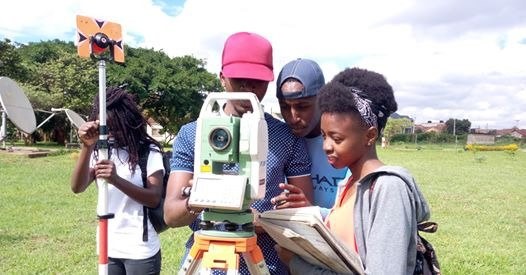
Before COVID-19, RCTI Students Using Total Station and a Prism during a Practical Session
Most technical courses under TVET programs are struggling with adjustment as those that fit into distance learning rarely depend on hands on practice. Those perfectly fitting stress more on academic subjects or basically don’t require a manual activity. Nevertheless, in RCMRD’s training section, some courses have weathered the storm with the introduction of eLearning – a learning portal with learning materials and resources that facilitate teaching. http://elearning.rcmrd.org/. Some of the courses utilizing this platform are Geographical Information system (GIS) which takes three weeks. GIS is a system designed to capture, store, manipulate, analyze, manage, and present spatial or geographic data of the earth’s surface. We train using software Open source QGIS and Commercial GIS (ArcGIS). The other course that has weathered the storm is International Computer Driving License (ICDL), a world leading computer certification that takes three months. The course is designed to equip learners with digital competency and targets everyone from four leavers to professionals. Currently, we are training four groups of ICDL students in various online platforms.
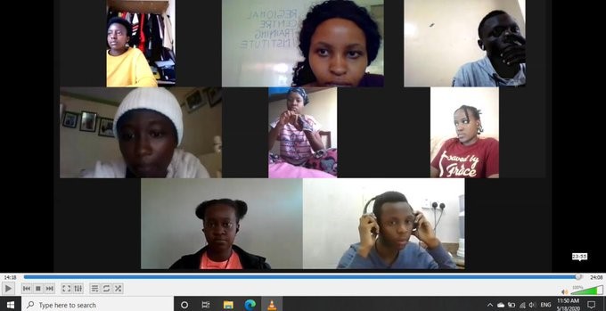
ICDL students from RCTI using zoom for online classes
These are achievements which may change the education system going forward as learners and their instructors will appreciate and embrace the value of digital devices at their disposal. This will lead to new inventions and innovations that will play a great role in providing accessible and competitive education. The section will experience a hybrid model of education which will emerge, with significant benefits.


