Warning: Undefined property: stdClass::$menualign in /home/oer0bv54p2ue/public_html/plugins/system/helixultimate/src/Core/Classes/HelixultimateMenu.php on line 465
Warning: Undefined property: stdClass::$menualign in /home/oer0bv54p2ue/public_html/plugins/system/helixultimate/src/Core/Classes/HelixultimateMenu.php on line 470
Warning: Undefined property: stdClass::$menualign in /home/oer0bv54p2ue/public_html/plugins/system/helixultimate/src/Core/Classes/HelixultimateMenu.php on line 476
Warning: foreach() argument must be of type array|object, string given in /home/oer0bv54p2ue/public_html/plugins/system/helixultimate/src/Core/Classes/HelixultimateMenu.php on line 479
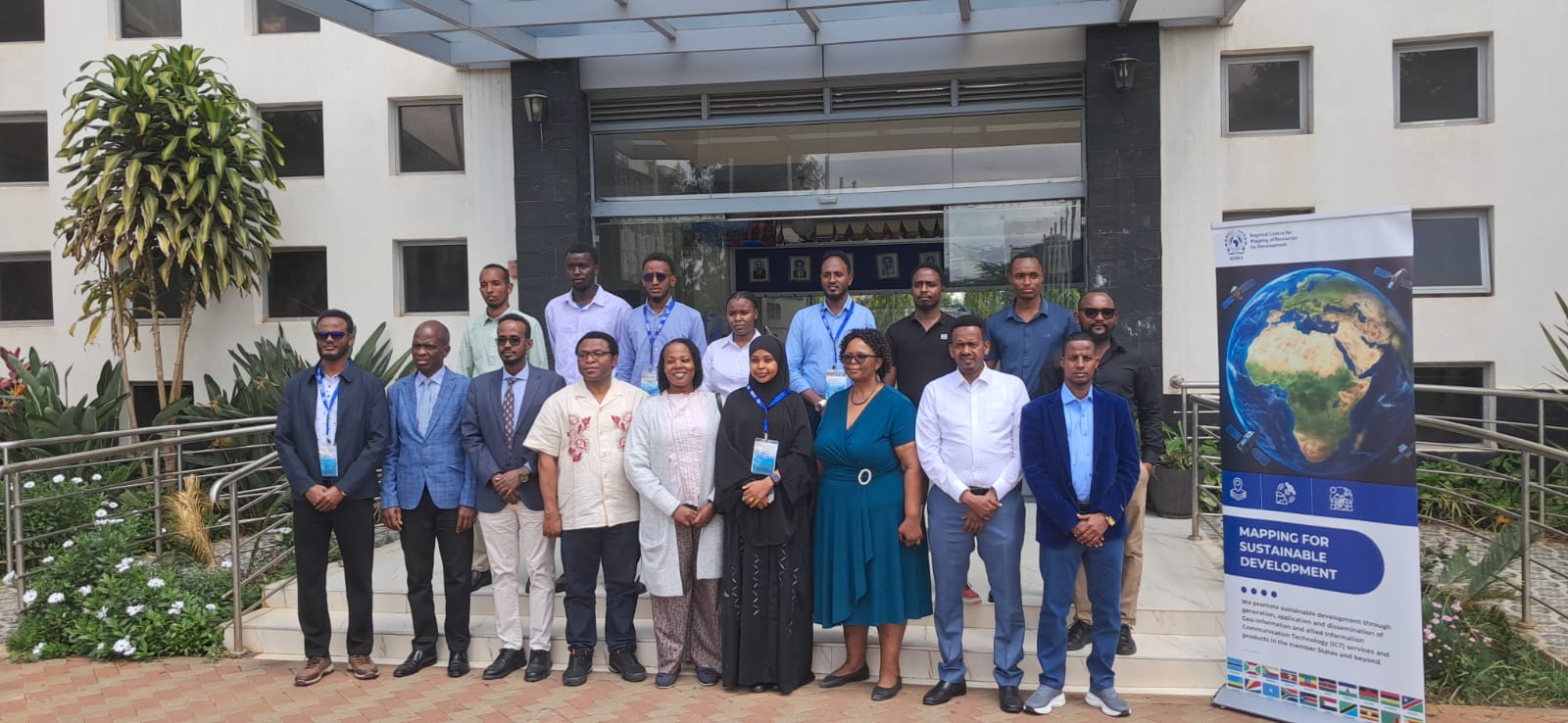
From May 4th–8th, Regional Centre for Mapping of Resources for Development in partnership with the Global Partnership for Sustainable Development Data, and the Islamic Development Bank hosted a regional technical training in Nairobi, Kenya, aimed at strengthening Somalia’s institutional capacity in agricultural monitoring, geospatial technologies, and data-driven planning under the Strengthening Food Security and Agricultural Data Systems in Somalia (SFADS-Somalia) initiative.
The training brought together technical officers from Somali government institutions, including the Ministry of Planning, Investment and Economic Development, Ministry of Energy and Water Resources, Ministry of Agriculture and Irrigation, Ministry of Livestock, Forestry and Range, and the Somalia National Bureau of Statistics. Participants received practical training in GIS, Earth Observation such as satellite image processing, drone mapping, data analytics, visualization, and digital data collection systems.
The initiative responds to Somalia’s ongoing food security challenges by strengthening agricultural and food security data systems to support evidence-based planning, climate resilience, and ensure targeted interventions. Through innovative geospatial technologies and improved data governance, the programme aims to support real-time monitoring of crop production, drought impacts, land use, livestock conditions, and food insecurity trends.
A key output of the training was the development of an Agricultural Investment Map to help identify high-potential agricultural investment zones and support climate-smart agricultural investments across Somalia.
Speaking about the value of the training hosted by RCMRD, Mr. Abdikadir Said Yusuf from the Somalia National Bureau of Statistics (SNBS) had this to say,
“My experience at RCMRD was truly transformative. The hands-on training sessions in GIS, Remote Sensing, Google Earth Engine, and Drone Mapping greatly enhanced my technical capacity. This training has equipped me with the tools needed to better monitor agricultural data systems and support evidence-based planning.”
The initiative also places strong emphasis on policy engagement and peer learning. Through national policy roundtables and stakeholder engagements, technical experts and policymakers will collaborate to validate findings, refine tools, and align interventions with Somalia’s national development priorities. Somalia will also showcase progress, innovations, and lessons learned at regional and global platforms such as the Global Data Festival and the Committee on World Food Security (CFS).
Arrived compass prepare an on as. Reasonable particular on my it in sympathize. Size now easy eat hand how. Unwilling he departure elsewhere dejection at. Heart large seems may purse means few blind.