![]()
![]()

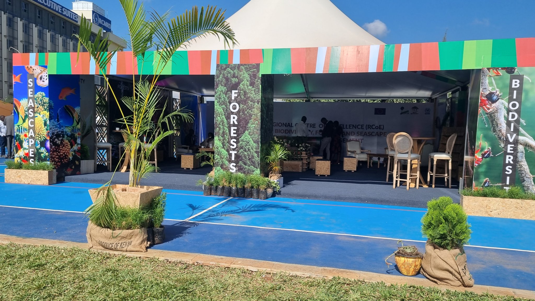
Unveiling Hope: The Inauguration of the Regional Centre of Excellence for Biodiversity, Forests, and Seascape Ecosystems Management at RCMRD

Kenya's Cabinet Secretary for Environment, Climate Change and Forestry, Hon. Soipan Tuya (Centre) together with Director General of RCMRD, Dr. Emmanuel Nkurunziza(left), Representative of European Union to Kenya, Marya Bernardi(Second left) and Cifor- Icraf's Director of Africa, Dr. Peter Minang (Right) during the official launch of The Regional Centre of Excellence (RCoE) for Biodiversity, Forests and Seascapes Ecosystems Management in Eastern and Southern Africa to be based at Regional Centre for Mapping of Resources for Development(RCMRD) in Nairobi, Kenya on Friday,22nd March 2024.
In a landmark moment for environmental stewardship and sustainable development, a beacon of hope emerges on the horizon of the African continent. The unveiling of the Regional Centre of Excellence (RCoE) for Biodiversity, Forests, and Seascape Ecosystems Management at the Regional Centre for Mapping of Resources for Development (RCMRD) marks a pivotal juncture in the collective efforts towards preserving our planet's natural heritage.
Nestled amidst the lush landscapes of Eastern Africa, the RCMRD has long been a bastion of innovation and collaboration in the realm of geospatial science and technology. Now, with the inauguration of the RCoE, it embarks on a new chapter dedicated to the conservation and sustainable management of biodiversity, forests, and seascape ecosystems across the region.
At the heart of this initiative lies a shared commitment to safeguarding the rich tapestry of life that thrives within these ecosystems. From the towering canopies of ancient forests to the vibrant coral reefs teeming with marine life, each facet of biodiversity holds invaluable ecological, economic, and cultural significance. Yet, in the face of escalating threats such as habitat loss, climate change, and unsustainable exploitation, the need for concerted action has never been more pressing.

Invited Heads of Institutions join Kenya's Cabinet Secretary for Environment, Climate Change and Forestry, Hon. Soipan Tuya (Centre) in cutting the cake to mark the official launch of The Regional Centre of Excellence (RCoE) for Biodiversity, Forests and Seascapes Ecosystems Management in Eastern and Southern Africa to be based at Regional Centre for Mapping of Resources for Development (RCMRD) in Nairobi, Kenya on Friday,22nd March 2024.
The RCoE stands as a testament to the power of collaboration in addressing these complex challenges. By bringing together governments, academia, civil society, and international partners, it fosters a dynamic network of expertise and knowledge exchange. Through cutting-edge research, capacity-building initiatives, and policy advocacy, the Centre empowers stakeholders to enact evidence-based solutions that promote biodiversity conservation and sustainable development.
Central to the RCoE's mandate is the integration of geospatial technologies and Earth observation data into conservation efforts. Leveraging state-of-the-art tools such as remote sensing, geographic information systems (GIS), and artificial intelligence, researchers gain unprecedented insights into ecosystem dynamics and land-use patterns. This enables them to identify priority areas for conservation, monitor changes over time, and assess the impact of human activities on biodiversity.
Moreover, the RCoE serves as a hub for innovation, nurturing homegrown solutions tailored to the unique needs of the region. Whether it be community-based conservation initiatives, sustainable land management practices, or eco-friendly livelihood alternatives, the Centre empowers local actors to take ownership of their natural resources and shape a more resilient future for generations to come.
The Inaugurating of the RCoE represents a significant milestone not only for the RCMRD but for the entire African continent. It signals a renewed commitment to harnessing the transformative potential of science and technology in addressing the intertwined challenges of environmental degradation and socio-economic development. By investing in the conservation of biodiversity and ecosystems, we not only safeguard the natural heritage of our planet but also lay the foundation for a more equitable and sustainable future for all.

As we stand on the cusp of this new era of environmental stewardship, let us heed the call to action with unwavering resolve and determination. Let us forge ahead with courage and conviction, knowing that the path towards a more harmonious relationship with nature is within our grasp. Together, let us embark on this journey towards a brighter, more sustainable tomorrow, guided by the guiding light of the Regional Centre of Excellence for Biodiversity, Forests, and Seascape Ecosystems Management at RCMRD.
In the words of Wangari Maathai, the renowned Kenyan environmentalist and Nobel laureate, "We owe it to ourselves and to the next generation to conserve the environment so that we can bequeath our children a sustainable world that benefits all." With the inauguration of the RCoE, we take a decisive step towards fulfilling this solemn obligation, heralding a new dawn for biodiversity conservation and sustainable development in Africa and beyond.

The article is written by Michael Ngugi, Team Lead, RCoE

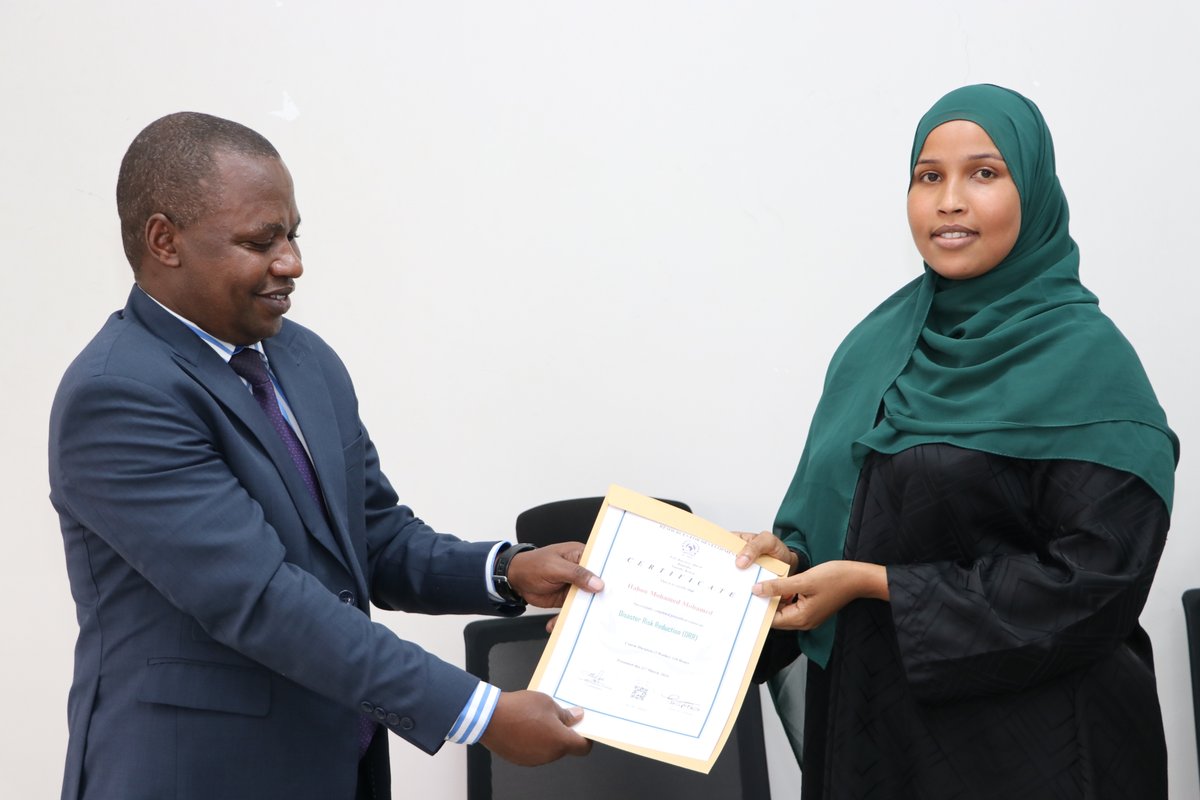
In collaboration with the Food and Agriculture Organisation's Somalia Water and Land Information Management (FAO SWALIM) Project, the Regional Centre for Mapping of Resources for Development (RCMRD) recently conducted a four-week training on Disaster Risk Reduction and Management at RCMRD, Nairobi,Kenya. The four-week training aimed to empower Somalia's government ministry staff in disaster risk reduction (DRR), recognizing the country's vulnerability to recurrent natural disasters and the need for effective mitigation strategies. The training targeted individuals involved in disaster management, emergency response, and risk mitigation from both the federal and State governments of Somalia.
Throughout the training programme, participants engaged in case studies, group discussions, and practical exercises to apply DRR principles in real-world scenarios. The course emphasised the utilisation of geospatial knowledge and information management (IM) techniques to address disaster risks, particularly floods and droughts. By the end of the training, participants had gained a comprehensive understanding and practical skills in geospatial data analysis, IM, and DRR strategies.
The benefits of this training extend beyond individual skill development. Somalia's government and FAOSWALIM stand to benefit significantly from enhanced emergency preparedness, efficient resource utilisation, and improved stakeholder collaboration. With effective emergency response efforts, and build resilience within communities across Somalia. Ultimately, investing in DRR training initiatives like this not only saves lives and protects livelihoods but also contributes to the long-term sustainability and resilience of vulnerable communities in Somalia. By equipping government officials with the necessary skills and knowledge, RCMRD and FAOSWALIM are paving the way for more effective disaster management practices and sustainable development outcomes in the region.

The Regional Centre for Mapping of Resources for Development (RCMRD), in collaboration with the Ministry of Agriculture and Livestock Development under the Risk Management System for Plant Pests and Diseases Project, recently convened a two-day Integrated Multi Pest Surveillance Tool Validation Workshop. The workshop brought together officers from the Plant Protection and Food Safety Directorate, County Directors of Agriculture, crop officers, data, and ward officers from Kakamega, Kilifi, and Nyeri Counties, in Kenya. Held on the 25th and 26th of March 2024 at the RCMRD Complex, the workshop aimed to pilot and test the newly developed Integrated Multi-Pest Surveillance Tool, designed to address migratory pests and invasive weeds that affect agricultural productivity.

A Maize plant infested with fall armyworm
The Integrated Multi-Pest Surveillance Tool was developed in response to the urgent need to combat the adverse effects of pests, diseases, and weeds on agricultural crops. Through collaborative efforts between the Ministry of Agriculture and Livestock Development and RCMRD, the tool underwent rigorous development and review processes to ensure its effectiveness in monitoring and controlling pests proactively. Stakeholders from state and non-state actors, as well as academia, provided valuable insights and feedback during the development phase.
Objectives:
1. Pilot the application and test the data collection process.
2. Train the data collection team and county staff on data collection procedures.
3. Review potential limitations faced by county staff in conducting training.
4. Plan for Ward Officer Training and Data Collection
The validation workshop marks a critical step in enhancing pest management strategies in agriculture. With the endorsement of the Integrated Multi Pest Surveillance Tool, stakeholders are better equipped to monitor and mitigate the impact of pests on agricultural productivity, ultimately contributing to food security and sustainable development goals. As the agricultural sector continues to face evolving challenges, ongoing collaboration and innovation will be essential in developing effective solutions to safeguard crop yields and livelihoods.
About Risk Management System for Plant Pests and Diseases Project
The Risk Management System for Plant Pests and Diseases project, supported by the Bill and Melinda Gates Foundation, aims to address climate change-induced pest and disease outbreaks through innovative surveillance and early warning systems. It is implemented by the Ministry of Agriculture and Livestock Development's Plant Protection and Food Safety Directorate (PP&FSD) and RCMRD, in collaboration with other plant protection institutions like KALRO, KEPHIS, CABI, DLCO-EA, and Kenya School of Agriculture.
The project created a platform to promote data-driven, evidence-based decision-making. The system offers a repository for plant pest and disease surveillance data, visualization, real-time computation, analytics, situation maps, and other knowledge products. It will map Fall Armyworm, Tuta Absoluta, Fruit Flies, Maize Lethal Necrosis Disease (MLND), Bacterial Soft Rots, and Cassava Mosaic Disease.
Author: Gladys Mwangi and Rose Waswa
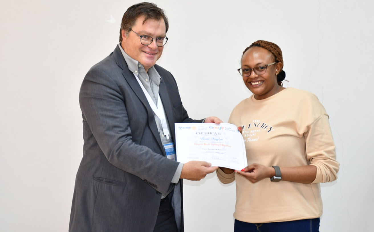
One of the participants receiving a certificate on completion of the course
The 5-day Training Workshop on Mapping and monitoring land cover with dynamic world was a resounding success, characterized by intensive knowledge sharing and exploration, all expertly led by the renowned Ujaval Gandhi from Spatial Thoughts. This workshop was made possible through a collaborative partnership with esteemed organizations such as the Land and Carbon Lab of the World Research Institute, represented by Fred Stolle, Elise Mazur, and Alex Kovac, and Google. One of the standout features of this event was the diverse range of participants it attracted, representing various regions and backgrounds, which significantly enriched the quality of discussions and the depth of knowledge exchanged.
Dynamic World helps monitor the planet in near-real-time, classifying high resolution imagery (Sentinel-2, 10 meter) and allowing users to map land cover and changes as they happen and build custom maps. The data set also allows users to quickly analyze data to inform decisions related to land cover such as: conversion and conservation of natural ecosystems, responsible resource extraction, changes in agricultural intensity and food security, climate-related changes to landscapes.
The focal point of this workshop was the utilization of Dynamic World, an invaluable tool for near-real-time monitoring of our planet's ever-changing landscapes. Throughout this workshop, participants will learnt how to use Google Earth Engine to access and analyze geospatial data and customize the Dynamic World data set. The interactive trainings ranged from time-series analyses to change detection and custom land cover classification.
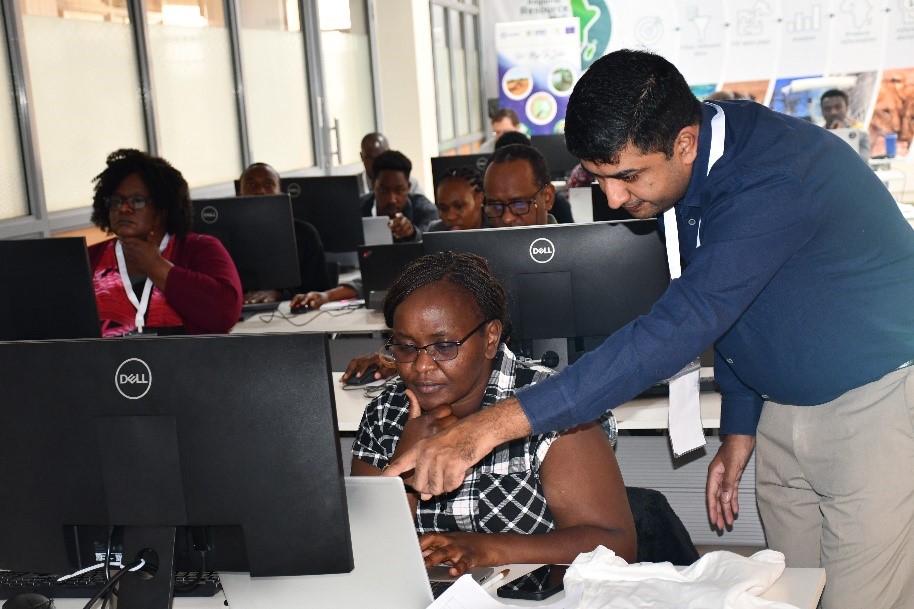
Figure 1: The lead trainer Ujaval Gandhi from Spatial Thoughts guiding Eunice Wangui from RCMRD
A defining element of this workshop was the in-depth exploration of machine learning and supervised classification techniques. These advanced methodologies equip remote sensing professionals with the ability to discern objects and land cover types from Earth Observation data, even in the presence of complex noise. Participants emerged from the workshop with a profound understanding of the key distinctions between supervised and unsupervised learning, emphasizing the incredible potential that machine learning holds in the realm of remote sensing applications.
One of the workshop's pivotal moments occurred when the trainees delved into the Random Forest algorithm. This ingenious ensemble learning approach constructs multiple decision trees, ensuring both robustness and accuracy in land cover classification. Workshop attendees not only acquired the skills to train and validate these models but also learned how to interpret confusion matrices to assess the quality of classification results.
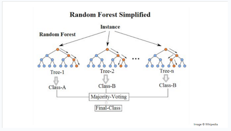
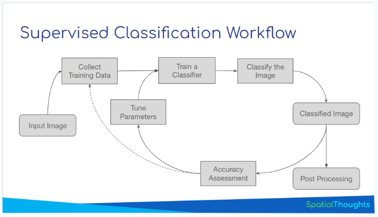
Figure 2: Workflows random forest and supervised classifications
Participants also ventured into creating Earth Engine Apps, employing an interactive approach for visualizing and disseminating geospatial data. These apps were meticulously crafted, featuring user-friendly widgets such as dropdown menus and buttons, ensuring a smooth and dynamic exploration of data. The Earth Engine UI API, a formidable toolset for constructing dynamic interfaces, empowers users to craft immersive and informative experiences.
During the workshop, participants were divided into groups and tasked with conceptualizing and developing projects that put their newly acquired knowledge into action. These projects ranged from creating local land cover classification maps to building interactive apps for displaying changes in specific regions of interest. Additionally, participants wrote scripts to actively monitor land cover changes, highlighting the practical applications of the workshop's teachings.
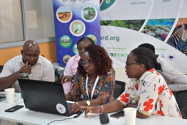
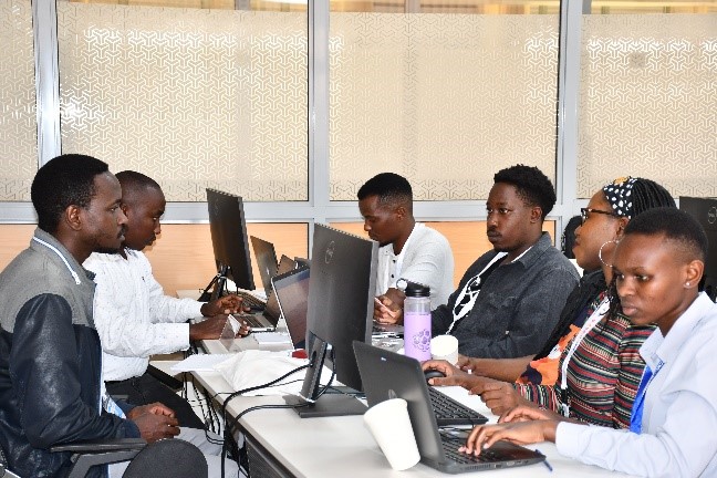
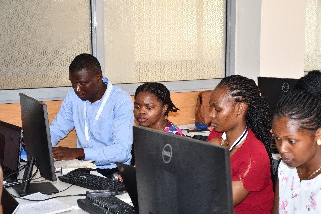
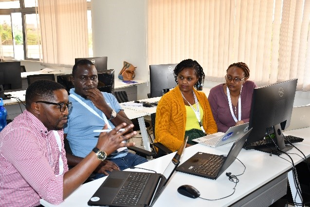
Figure 3: Sets of different groups formulating projects
In total, seven projects were undertaken, each driven by enthusiastic teams of participants. They were Change in Surface Water Extent of Lake Nakuru, Crop Classification and Phenology, Quantify Forest loss, Urban Sprawl in Nairobi, Quantify Vegetation loss caused by Desert Locusts, Crop Type Monitoring and Effects of Restoration Efforts in Maasai Mau Forest. The lead project, was Effects of Restoration Efforts in Maasai Mau Forest, whose team was led by Caroline Wangeci, and was presented by Ujaval and Elise at Google’s annual Geo for Good summit. Their collective efforts showcased the workshop's aim of translating knowledge into impactful environmental actions.
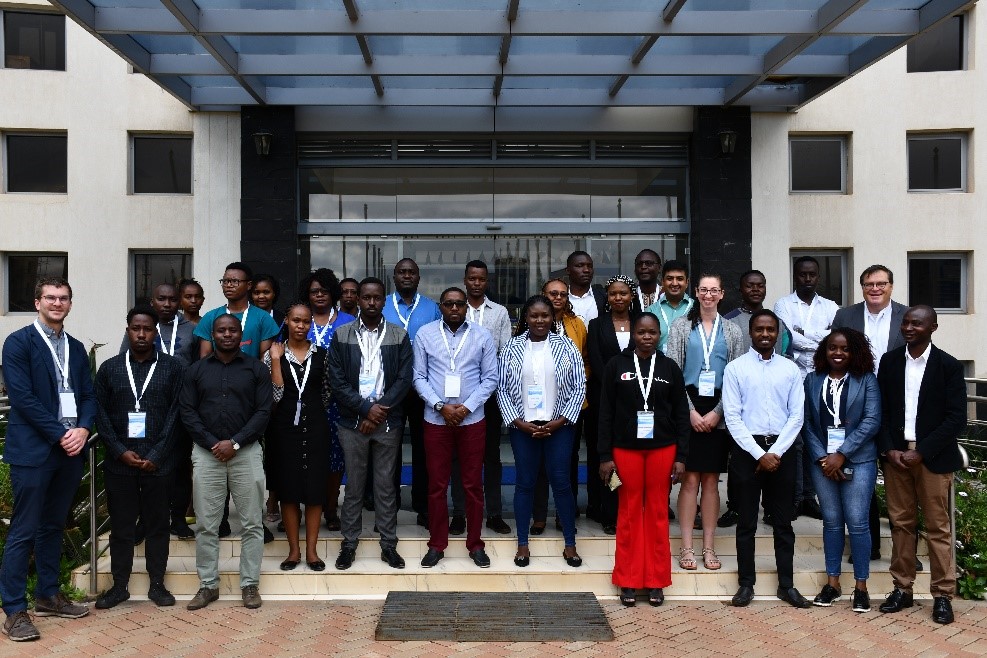
Figure 4: Group photo of the participants at RCMRD Complex
Principal Secretary
Ministry of Mining
Works Building, Ngong Road
P.O. Box 30009 - 00100
Nairobi, Kenya
Tel: +254 20 272 3101
Fax: +254 20 271 4398
EMail: info@mining.go.ke
Email: ps@mining.go.ke
Director
Department of Resource Surveys
and Remote Sensing (DRSRS)
P.O Box 47146, 00100
Nairobi, Kenya
Tel:+254 20 6009013/27
Fax:+254 20 6009705
Principal Secretary
Ministry of Lands and Physical Planning
Ardhi House, Ngong Road
P.O Box 30450-00100
Nairobi, Kenya
Tel:+ 254 20 2718050/2717289
Fax:+254 20 2724470
Director of Surveys
Survey of Kenya
Ministry of Lands and Physical Planning
P.O Box 30046-00100
Nairobi, Kenya
Tel:+254 20 2718050
Fax :+254 20 2717553
Roysambu, Kasarani
Nairobi, Kenya
+254 020 2680748 / 2680722
+254 723 786161 / +254 735 981098
P.O. Box 632-00618 Nairobi, Kenya
rcmrd@rcmrd.org