Roysambu, Kasarani
Call: +254 723 786161 / +254 735 981098 | ISO 9001:2015


Authored by Gladys Mwangi in collaboration with the RCMRD PASSAGE Project team
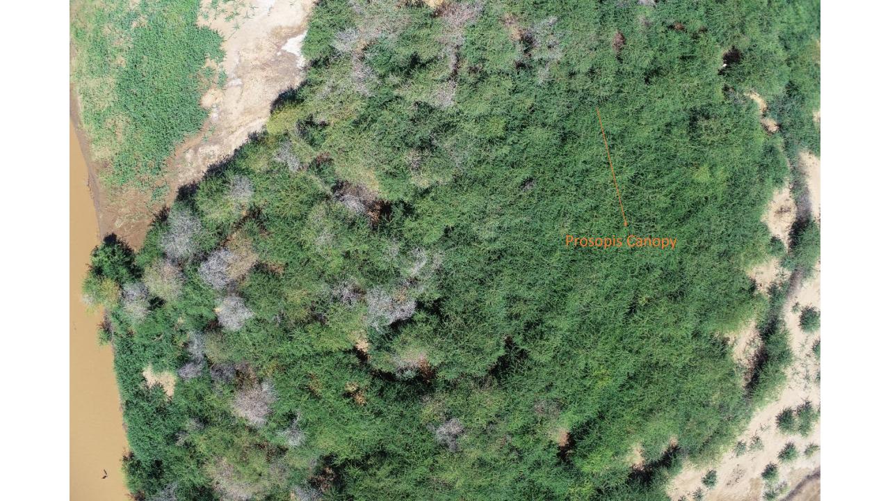
Across the vast, dry landscapes of Turkana County, a quiet transformation is taking place. Thickets of Prosopis juliflora, locally known as Mathenge, are steadily spreading across grazing lands, riverbanks and water catchments, changing the landscape on which pastoral communities depend.
The story of Prosopis in Kenya is not entirely one of harm.
The species was introduced in the 1970s to help rehabilitate degraded land, control soil erosion and provide communities with fuelwood, charcoal and fencing material. Its deep roots can help stabilise soils, while its wood provides energy and construction materials. In some areas, its seed pods have also been used as livestock feed during prolonged dry periods. But in Turkana, the species has spread far beyond its intended purpose.
Turning Earth Observation into Action
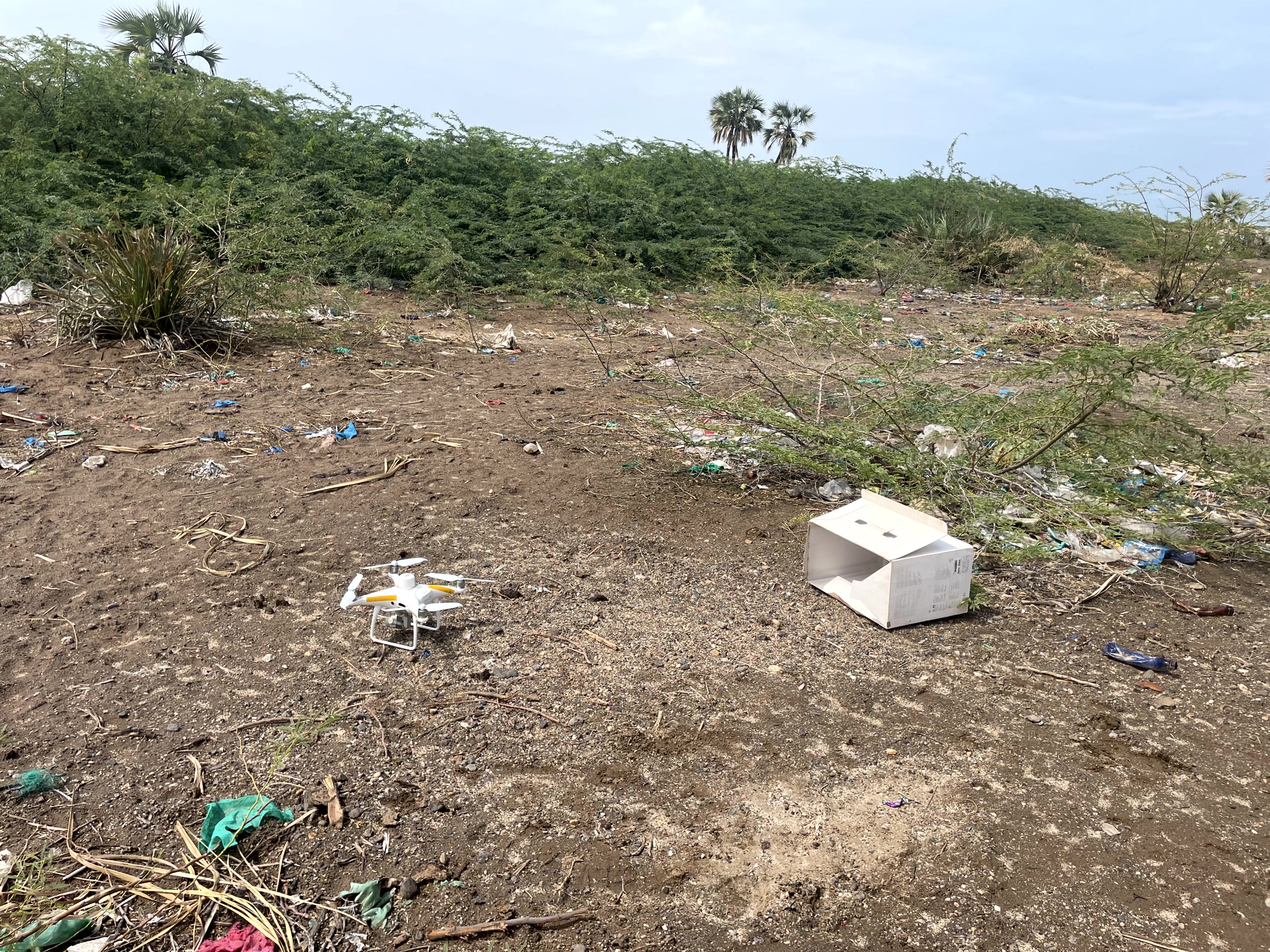
The scale of Turkana makes responding to this challenge particularly difficult. Covering more than 77,000 square kilometres, the county is vast, remote and characterised by terrain where conducting frequent ground surveys across every affected area would be costly and time-consuming. This is where Earth Observation can change the picture.
Through the PASSAGE Project, the Regional Centre for Mapping of Resources for Development (RCMRD) is using satellite data, geospatial technologies and spatial analysis to build a clearer understanding of how Turkana's landscape is changing.
Instead of relying on isolated observations from the ground, satellite imagery allows the landscape to be viewed repeatedly and systematically across large areas. This makes it possible to identify where Prosopis is concentrated, understand its relationship with surrounding vegetation and establish areas that require closer investigation or intervention.
Reading the Landscape from Space
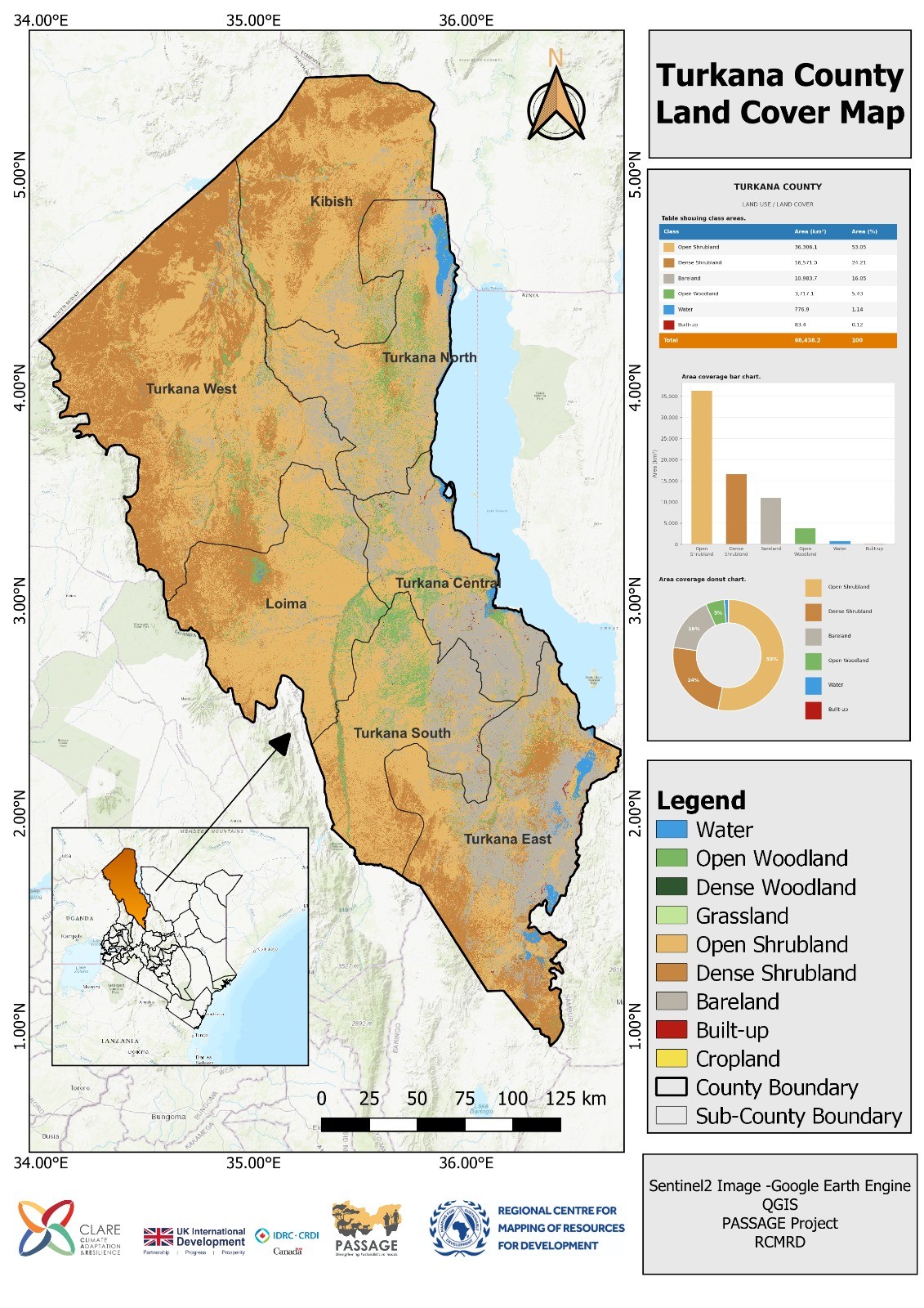
Developing these maps involves more than simply looking at satellite images. RCMRD uses Sentinel-2 satellite imagery, which provides multispectral observations that allow different land-cover characteristics to be examined across the landscape.
The imagery captures information in visible and infrared portions of the electromagnetic spectrum, helping distinguish vegetation from bare ground, water and other land-cover types. This spectral information is particularly important when mapping vegetation. Different vegetation types reflect and absorb electromagnetic energy differently depending on factors such as leaf structure, moisture content, density and overall vegetation condition. These differences can be analysed to identify patterns associated with grasslands, shrublands, woodlands and other vegetation classes.
From Maps to Management
The value of these maps does not end when the mapping is complete. The Kenya Forestry Research Institute (KEFRI) and the Turkana County Government are using the Land Cover and Prosopis Distribution Maps as evidence to support the development of the Turkana County Prosopis Management Plan. This is an important shift from mapping for information to mapping for action.
The spatial evidence can help decision-makers identify invasion hotspots, prioritise areas for restoration, guide invasive species control measures and identify vulnerable ecosystems where intervention may prevent further degradation. The maps also provide something equally important: a baseline.
By comparing satellite imagery acquired over different seasons and years, RCMRD and its partners can track how the distribution of Prosopis changes over time. New invasion areas can be identified, while previously affected areas can be monitored to determine whether management interventions are containing or reversing the spread. This creates an opportunity for continuous monitoring rather than one-off assessments. It also means that investments in restoration and invasive species management can increasingly be guided by evidence showing where intervention is most needed and where it can have the greatest impact.
From Data to Climate Resilience
The experience in Turkana demonstrates the growing role of Earth Observation in managing climate-vulnerable landscapes.
In environments where ecosystems are changing rapidly and ground-based monitoring is difficult, satellite technology provides a consistent and scalable way of observing change. But the technology itself is only part of the solution. The real value comes when Earth Observation data is transformed into information that governments, technical institutions and communities can use to make decisions.
Through the PASSAGE Project, RCMRD is combining geospatial expertise, Earth Observation, spatial analytics and capacity building to strengthen that connection between data and action. For Turkana, understanding where Prosopis is spreading is the first step towards managing it.
For the wider drylands of Africa, the lesson is broader: effective environmental management begins with knowing how the landscape is changing. From space, changes that may be difficult to see across thousands of square kilometres become patterns that can be measured, mapped and monitored. And with better evidence, Turkana can move from reacting to environmental degradation to planning where restoration, protection and intervention are needed most—helping safeguard rangelands, pastoral livelihoods and ecosystem resilience for generations to come
Reference
Clement, Ndaio E., Agevi Humphrey, and Obiri John. 2020. “Impacts of Prosopis juliflora on Abundance and Species Diversity of Forage Species in Turkana County, Kenya.” Current Journal of Applied Science and Technology 39 (33): 112–125. https://doi.org/10.9734/cjast/2020/v39i3331026.

